Legacy Wellhead Leak Monitoring

Drone Surveys
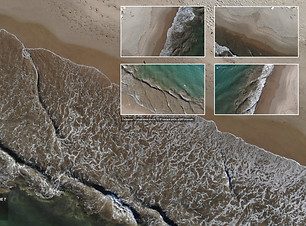
Using programmed waypoint software, our drone pilots fly coordinate-specific pathways to monitor any leakage from various Legacy Oil Wellhead sites, ensuring that we are monitoring the exact site location every time.

Photogrammetric Mapping
SkyeBrowse software had allowed us to construct precise photogrammetric, 3D models of Rincon Island, the center of one of the wellhead survey sites.

Status reporting
Consistent and timely monitoring allows us to compare data at the exact same locations over various days to monitor for any oil sheen. Repeated occurrences of oil in the vicinity of a wellhead can suggest a leak that can then be addressed.


Utilizing years of documentary work coupled with research, On the Wave Productions' " Marine Research division" along with local Santa Barbara non-profit Heal the Ocean has leveraged it’s expertise with both aerial and land based image acquisition to create tools for locating leaking wellheads.
On the Wave has provided detection of leaking wellheads along with monitoring of the Offshore platforms, Summerland, Rincon Island and Ventura locations over the past 7 years. Working alongside California State Lands Commission and their subcontractors OTW was onsite during the capping of 7 prolific leaking wellheads along the coast of California from 2017 to 2023. We continue our pledge to keep our ocean and shorelines free of hydrocarbon pollution.
With regard to regular monitoring, OTW developed autonomous flight plans to ensure consistently accurate surveys, first locating the wellheads , verifying coordinates are accurate and then programming our drones for autonomous flight which keeps monitoring costs at a minimum. Presently we are in the middle of a 2 year study with the goal of improving well abandonment now and in the future. The Summerland Oil Mitigation Study (SOMs) goals is to help improve the methods by which leaking wellheads are capped–safely and with minimal pollution to their environment during and after an abandonment takes place. This study was commissioned by Heal the Ocean for State Lands and funded byState of California's Ocean Protection Council, Manitou Fund and Mericos Foundation.


